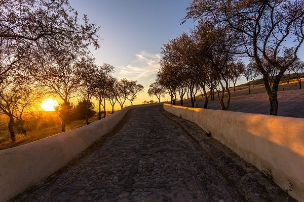
Lots of folks are kicking the tires on the Alentejo and who can blame them. This vast southern province of Portugal is unique. It has a long sandy Atlantic seacoast, well conserved and protected. The rolling plains are breathtaking, and punctuated by cork forests, olive groves, wine fields, and hilltop fortified towns. But there is a 180 mile strip of land from Marvão to Mértola, mostly unknown to many foreigners, which is too bad. Called "A Raia" in Portuguese (the stripe), the border has remained mostly unchanged since the 13th Century and the Treaty of Alcanizes. The Alentejo border runs for 180 miles from the North to the South, one of the longest uninterrupted borders in Europe. Portugal’s history officially starts in 1143 as an independent nation. The Treaty of Zamora on October 5, 1143 recognized Portuguese independence from the Kingdom of León (Spain would not emerge for another 350 years.).
With an open border today, these towns and villages offer a unique tale of commerce, history and cultural interaction. It is unlike any place else in Europe. There are castles, convents, farming towns, and rolling fields. Here Portuguese and Spaniards dine side by side, and share common land, and a culture that has flourished since the border opened. Here are a few places you can see a Raia:
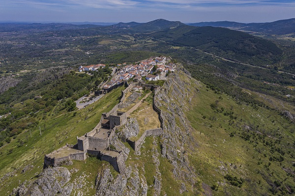
The mighty Castle of Marvão overlooks the village of Santa Maria de Marvão, a few miles from Spain. Marvão is still a place of convergence: here meet people such as Celts, Vettones, Lusitanian Romans, Suevi, Vandals, Visigoths, Moors, Templars and Portuguese (and on occasion the uninvited Castilian). Today, Spanish visitors are common here and in the pretty town of Castelo de Vide, just down the road.
Marvão's natural high hilltop is a walled 'eagle's nest' - set high on a granite mountain top, and bordered to the south and west by the Sever River. It was rebuilt by a young Portuguese nation in 1299 to discourage invasions. The village’s coat of arms prominently features a set of keys, as a result. The intact walls and castle still feel invincible and soaring. There are views that go on for miles on a clear day, commanding views across the Tejo River Valley to the Serra de Estrela to the north. Marvão with just 3,000 people is the key to the borderlands, and retains its official title of ‘Mui Nobre e Sempre Leal Vila de Marvão' (Very Noble and Ever-Loyal Town).
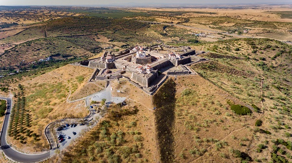
"Elvas, with Badajoz in view," is an old saying about this Alentejo border city. Elvas once guarded the road to Lisbon and was heavily refortified between the 17th to the 19th centuries to offer the largest bulwarked dry ditch system in the world. Within Elvas’ massive walls, are a host of barracks and other military buildings as well as churches and monasteries. The city has probably always been walled, but the War of Restoration brought new forts and walls planned by the Dutch Jesuit Cosmander – so Elvas has the best surviving example of the Dutch school of fortifications on earth. The site also offers the Amoreira aqueduct, built to withstand lengthy sieges.
Today, Elvas has 23,000 inhabitants, and some 12 small forts. The walls’ dry moat defensive system is considered a masterpiece that World Heritage described as "an outstanding demonstration of Portugal’s desire for land and autonomy, and the universal aspirations of European nation States in the 16th-17th centuries.” The historic city has lots of great places to stay. The main plazas offer shops and places to eat, as well as a few miles of walls to climb and explore. With the city of Badajoz just a few miles away, Elvas is often busy with Spanish diners, shoppers and tradespeople. The gates are wide open, in a new era on that Aria.
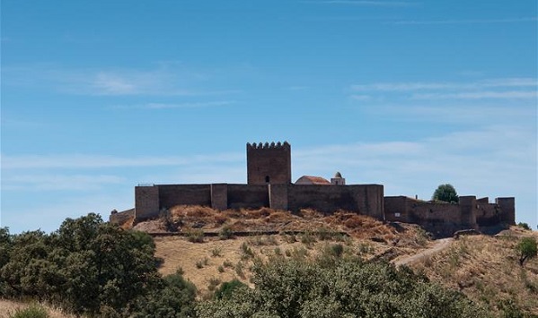
Barrancos is a village in the southern Alentejo region and is home to about 1,800 people. Set more than 20 miles from any other town, Barrancos is unique. It is surrounded by Spain on three sides. It has no fortifications that remain, as this was a market town.
Barrancos has been held by the Romans, Visigoths and Moors – and it became part of Portugal in 1167. Barrancos was refortified in 1200, and was then part of the county seat of Noudar. The town flourished as a market town - and since the opening of borders between Portugal and Spain, has become a mini-United Nations. Its busy main street is flanked with shops and cafes. The folks in these parts speak both Portuguese and Spanish to each other -everyone gets along and understands each other. The local cured ham of Barrancos has its own denomination of origin (PDO), and it stands out. In fact, many eateries will offer a plate of the region’s famous cured ham, or presunto, with a jar of red wine. Also, you can sample the açorda (bread stew) that is the pride of Barrancos. Or try the Barrancos migas (roasted bread crumbs) made with the rich local bread.
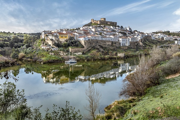

Mértola surprises the visitor with its rich heritage and amazing natural location. It sits high over the Guadiana River, facing Spain. Once known as Myrtillis Romana, the place flourished in the days of the Romans. But the vast walls were not enough to save the town from the Barbarian onslaught that ended the Roman rule of the Iberian Peninsula. By the 8th century, the arrival of the Moors had brought a new period of prosperity. Then, in 1238 the Portuguese king Dom Sancho II took the castle and handed it over to the Order of St. James. By 1300 a new castle had risen on the ruins of the old. The walls remained in constant reconstruction with Spain just across the Guadiana River. Today, Mértola is an archaeological jewel, with excavations revealing remains from the town’s many rulers of the past 3,000 years. Inside its walls thrives a beautiful town, rich in simple houses, old cannons, and flowers. The vast cistern and castle keep are testaments to the town’s bellicose past. It also boasts the only still-standing Moorish mosque in Portugal. The square mosque, now a church, is a unique example of the lost riches of Arab Portugal.
